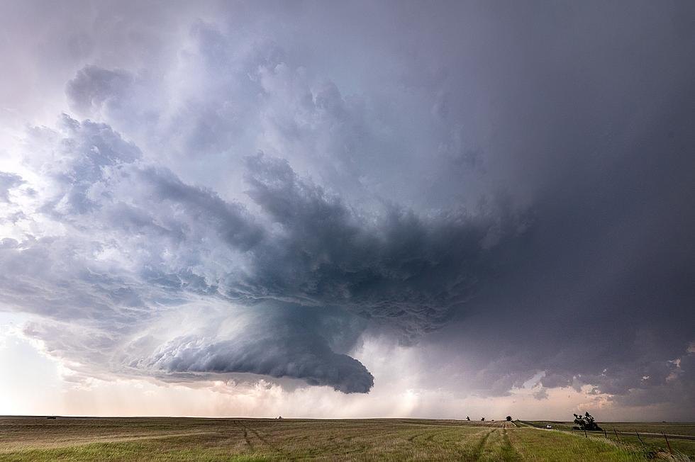
5 Things You Can Do to Prep for the Powerful Overnight Storms in the Evansville Area
Though December weather in the Midwest is usually mild, a huge storm system tonight is rolling in tonight. Whether we like it or not, we are about to get rocked by a series of powerful thunderstorms that could produce significant amounts of rain, damaging winds, and possibly even hail and strong tornadoes. The greatest threat in the tri-state is from 9 PM to 4 AM. Here's a map that gives a better overview of when you can expect to see the worst of it.
According to the NWS,
An organized outbreak of severe thunderstorms is possible tonight. The main hazards will be damaging winds and tornadoes, including the potential for a couple strong tornadoes.
Thunderstorms are expected to develop by mid to late evening across southeast Missouri and southern Illinois, then continue through the overnight hours across southwest Indiana and western Kentucky. Conditions will be favorable for damaging winds and tornadoes along a broken line of storms, and a couple long-track tornadoes are possible.
Outside of thunderstorms, areas of fog will limit visibility in some locations, especially portions of southeast Missouri, through the morning. And strong gradient non-thunderstorm wind gusts of 30 to 40 mph are possible tonight into early Saturday morning.
The NWS is also asking you to prepare yourself. Here's what you need to do.
MAKE SURE YOU CAN RECEIVE ALERTS
Make sure you have a weather radio handy. If you don't have one, you can get one today at a sporting goods store or big box store.
Make sure you can receive alerts on your phone. Here are directions on making sure they are on. You can also register at codered.org To create your account and set up your registration to receive CodeRED alerts, you can visit Public.CodeRED.org and follow the directions provided to register to begin receiving alerts.
And make sure you download our app and turn on alerts for more updates as they become available from the NWS and Eyewitness News.

HAVE CLOTHING & SHOES PREPPED
Get your running shoes and appropriate clothes ready. Have them next to your bed in case you need to make a break for it.
BREAK OUT THE WEATHER HELMET
This can be any kind of helmet you have handy such as a bike helmet or construction hard hat. Better to be safe and a little dorky looking than sorry.
HAVE A PLAN IN PLACE
Have a plan in place before you get a tornado warning. The CDC recommends, "Go to the basement or an inside room without windows on the lowest floor (bathroom, closet, center hallway). If possible, avoid sheltering in a room with windows. For added protection get under something sturdy (a heavy table or workbench). Cover your body with a blanket, sleeping bag or mattress."
PREPARE FOR OUTAGES
In the event of a power outage, make sure you are ready. Have a working flashlight handy for each person in your household. And make sure your phone is charged as well as your portable battery charger.
TIPS: Here's how you can prepare for power outages
KEEP READING: Get answers to 51 of the most frequently asked weather questions...
KEEP READING: What to do after a tornado strikes
More From WGBFAM


![Evansville, IN Home’s Decorations Look Like A Hallmark Christmas Movie Set [PHOTOS]](http://townsquare.media/site/71/files/2020/12/514b41e6bef44ab61cd041e17fde5cb9l-m23671028od-w1024_h768.jpg?w=980&q=75)