
Southern Indiana and Western Kentucky Upgraded to Moderate Risk for Severe Weather on Wednesday
If you were hoping the line of storms forecasted to sweep across the Tri-State area late Wednesday afternoon would weaken as they got closer, you're not going to like what the National Weather Service's Storm Prediction Center (SPC) has to say.
Southern Indiana and Western Kentucky Upgraded to Moderate Risk for Severe Weather
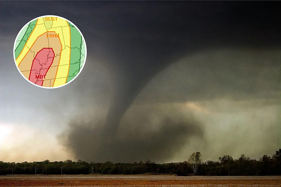
Since late last week, the SPC has been monitoring a weather system making its way toward the area and alerting residents that it has the potential to be severe. They all but confirmed that would be the case when they placed the entire area under an Enhanced Risk (level 3 out of 5) for severe weather on Monday. Unfortunately, new data Tuesday afternoon showed the potential for severe weather to be significant enough the SPC has bumped the threat up a level to a Moderate risk.
What Does a Moderate Risk for Severe Weather Mean?
The Storm Prediction Center grades severe weather threats on a scale of one to five with one being "Marginal" and five being "High." As you can see in the graphic below, a Moderate Risk has the potential to cause significant damage to the areas it impacts, meaning you should have your family prepared to go to wherever your save space happens to be inside your home should you need it Wednesday afternoon and evening.
According to the Storm Prediction Center, the weather system has the possibility to play out as follows:
Numerous severe thunderstorms appear likely across a large portion of the lower/mid Mississippi Valley into the Midwest, and lower Ohio Valley on Wednesday. Damaging winds, some of which could be significant, several tornadoes (some strong), and large to very large hail will likely occur.
The statement goes on to say how much the initial round of thunderstorms Wednesday morning disrupts the atmosphere will have an impact on the severity of the second and potentially more dangerous round Wednesday afternoon.
This potential may be conditional on the degree of destabilization that can occur behind early-morning rain/weak thunderstorms that should exit the region by early afternoon. However, if discrete convection can become established, all hazards will be possible, including the potential for large hail and strong tornadoes.
You can read the full statement on the Storm Prediction Center website.
Be Prepared for Severe Weather
In the event things get bad to the point where you and your family may be in danger, we will simulcast coverage from our media partners at Eyewitness News. Be sure to have our app on your phone to receive notifications for any and all watches and warnings, and to listen live in the event that happens.
[Source: National Weather Service Storm Prediction Center]
KEEP READING: What to do after a tornado strikes
TIPS: Here's how you can prepare for power outages
More From Evansville News