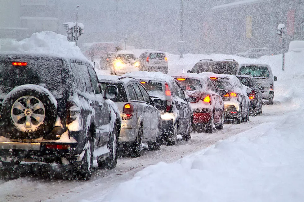
INDOT Prepared for Freezing Rain Predicted for Portions of Indiana this Weekend
The Indiana Department of Transportation is monitoring multiple weather forecasts predicting a mix of rain, freezing rain, snow and ice to move across Indiana beginning Friday evening. A few degrees can mean the difference between rain, ice or snow, so freezing rain can be difficult for forecasters to pinpoint far in advance. INDOT maintenance supervisors will continue monitoring developing conditions and reports from law enforcement and the public to supplement local weather forecasts.
If the forecast indicates frost or other freezing weather, INDOT sprays a salt-water mixture to pre-treat bridges, which are likely to freeze first. If a storm is predicted to lead off with rain, salt trucks pre-treat our roads just before pavement temperatures fall below freezing and the snow and ice begin to accumulate. INDOT will adjust its call out of manpower, trucks and materials as appropriate to address changes in forecasted and observed road conditions. Trained INDOT employees are on call to staff plow trucks around the clock with alternating 12- to 16-hour shifts.
Freezing rain and ice can be the most dangerous and difficult conditions for drivers and plow trucks because it affects vehicles of all sizes, including those with four-wheel drive. Motorists are strongly encouraged to avoid non-essential travel within the times and areas where a coating of ice is forecasted to accumulate. Here are several steps that drivers can take to minimize the risk of losing control on icy roads: Consult hourly weather forecasts and schedule high-speed and long-distance trips during the warmer hours of the day. This will help save the extra time needed to slow down and drive according to the conditions.
Know before you go by checking the red-yellow-green traffic speeds on your map app or http://indot.carsprogram.org. Monitor current air temperatures and slow down if conditions are near or below freezing. Watch how salt trucks, emergency vehicles and other drivers are responding to the weather. Apply anti-lock brakes firmly when encountering ice. Pump brakes that are not anti-lock. Do not overcorrect with steering.
Drivers can monitor road conditions and traffic alerts across the state at any time. Visit www.TrafficWise.IN.gov or dial toll-free 800-261-ROAD (7623) for INDOT’s TrafficWise Traveler Information Service. Subscribe to receive text and email alerts about INDOT projects and services at http://bit.ly/INDOTsubscription. Find links to INDOT’s regional Facebook and Twitter pages at http://bit.ly/INDOTsocial. INDOT will be providing snow and ice removal updates with posts tagged #INDOTWinterOps.
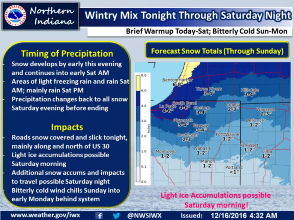
Hazardous Weather Outlook from the National Weather Service
JEFFERSON-WAYNE IL-EDWARDS-WABASH-PERRY IL-FRANKLIN-HAMILTON-
WHITE-JACKSON-WILLIAMSON-SALINE-GALLATIN-UNION-JOHNSON-POPE-
HARDIN-ALEXANDER-PULASKI-MASSAC-GIBSON-PIKE-POSEY-VANDERBURGH-
WARRICK-SPENCER-FULTON-HICKMAN-CARLISLE-BALLARD-MCCRACKEN-GRAVES-LIVINGSTON-MARSHALL-CALLOWAY-CRITTENDEN-LYON-TRIGG-CALDWELL-UNION KY-WEBSTER-HOPKINS-CHRISTIAN-HENDERSON-DAVIESS-MCLEAN-MUHLENBERG-TODD-PERRY MO-BOLLINGER-CAPE GIRARDEAU-WAYNE MO-CARTER-RIPLEY-BUTLER-STODDARD-SCOTT-MISSISSIPPI-NEW MADRID-
710 AM CST FRI DEC 16 2016
THIS HAZARDOUS WEATHER OUTLOOK IS FOR PORTIONS OF SOUTHERN
ILLINOIS...SOUTHWEST INDIANA...WESTERN KENTUCKY AND SOUTHEAST
MISSOURI.
DAY ONE...TODAY AND TONIGHT
PATCHY FREEZING DRIZZLE IS POSSIBLE OVER THE OZARK FOOTHILLS OF
SOUTHEAST MISSOURI THIS MORNING...MAINLY NORTH AND WEST OF POPLAR
BLUFF.
DAYS TWO THROUGH SEVEN...SATURDAY THROUGH THURSDAY
ISOLATED THUNDERSTORMS ARE EXPECTED ON SATURDAY...MAINLY SOUTHEAST OF A LINE FROM POPLAR BLUFF MISSOURI TO EVANSVILLE INDIANA. GUSTY SOUTHWEST WINDS ARE EXPECTED ON SATURDAY...ESPECIALLY IN ANY THUNDERSTORMS.
TEMPERATURES WILL PLUNGE INTO THE TEENS SATURDAY NIGHT BEHIND AN
ARCTIC COLD FRONT. RAIN WILL END AS A PERIOD OF FREEZING
RAIN AND SLEET...THEN POSSIBLY A LITTLE SNOW. ACCUMULATIONS OF
WINTRY PRECIPITATION ARE FORECAST TO BE LESS THAN HALF AN INCH.
THE COMBINATION OF FALLING PRECIPITATION AND THE FREEZING OF WET
ROADS WILL RESULT IN ICY TRAVEL CONDITIONS...WHICH WILL PERSIST
INTO SUNDAY MORNING.
WIND CHILL READINGS EARLY SUNDAY MORNING WILL BE FROM ZERO TO 5
BELOW ZERO ACROSS SOUTHERN ILLINOIS AND PARTS OF SOUTHEAST
MISSOURI. MOST OF WEST KENTUCKY AND SOUTHWEST INDIANA WILL
EXPERIENCE WIND CHILLS IN THE SINGLE DIGITS. WIND CHILL READINGS
SUNDAY NIGHT AND EARLY MONDAY WILL FALL TO AROUND ZERO ACROSS THE REGION.
More From WGBFAM